
Things to Do
Plan experiences from the verified recommendations already published in WSD destination guides.
Experiences from destination guides
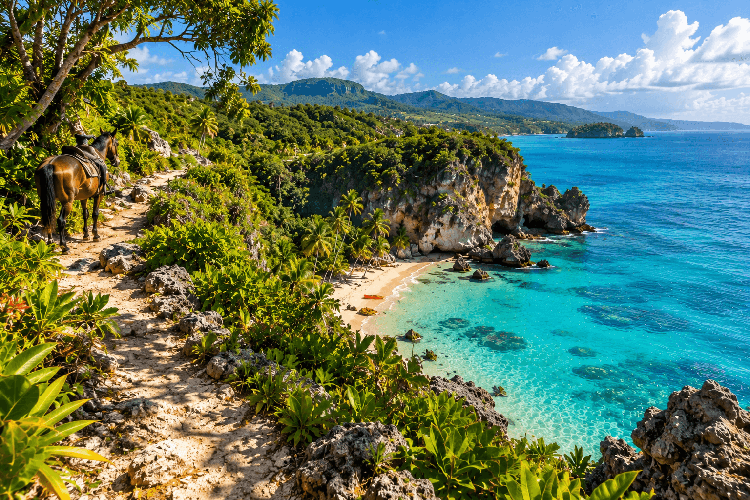
Drive the Barahona–Pedernales coastal road slowly
The sequence of San Rafael, Paraíso, Los Patos, Enriquillo and the increasingly dry southwest is the organizing experience of the destination. Stopping between rivers, viewpoints and pebble beaches is more valuable than racing straight to Pedernales.
Fuel, daylight and road time matter. Build margin instead of stacking too many nature stops into one transfer day.
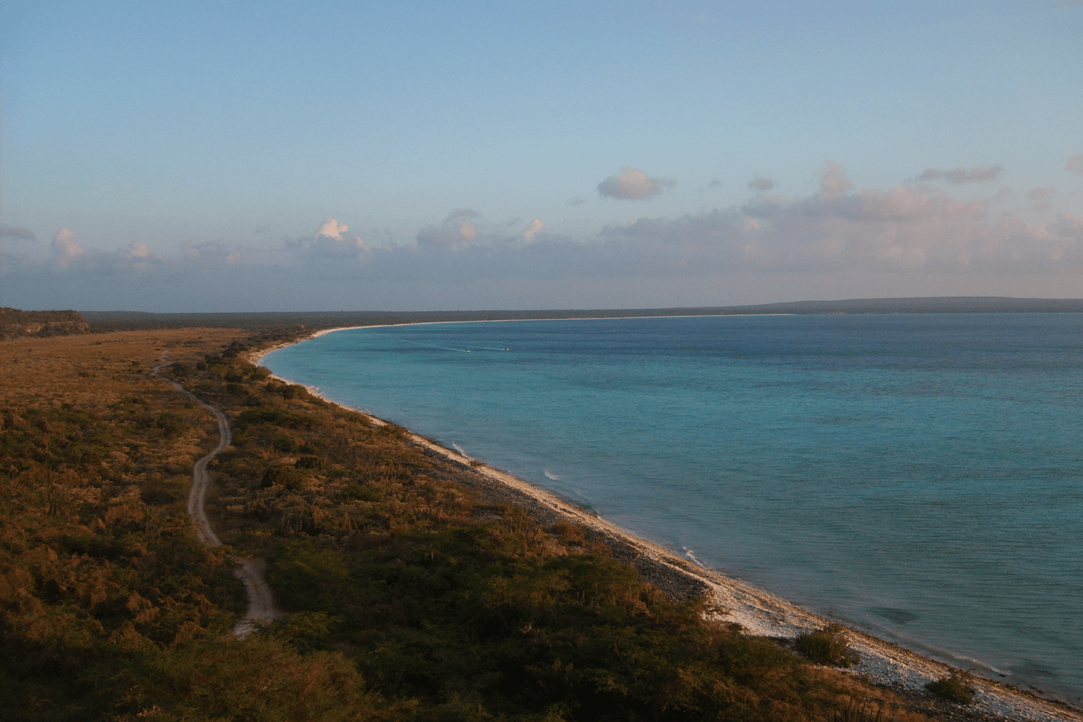
Experience Bahía de las Águilas as a protected-area visit
The beach is famous for white sand and clear water, but its significance is also that it remains inside the Jaragua protected landscape without hotels, shops or restaurants on the beach itself.
Bring sun and water planning and confirm current all-terrain vehicle or boat access.
Take a guided Laguna de Oviedo nature outing
Laguna de Oviedo adds a brackish wetland, cayes, birdlife and iguana habitat to a trip otherwise dominated by coast and mountains.
Wildlife sightings vary. Confirm current guide/boat arrangements and park procedures.
Climb into Sierra de Bahoruco and Hoyo de Pelempito
The highland road reveals one of the southwest’s strongest ecological contrasts, moving from dry lowlands toward cooler forest and the Hoyo de Pelempito viewpoint.
Use current park/road guidance and a suitable vehicle. Do not treat an old access report as proof of present road condition.
Stop for the river-to-sea landscapes of San Rafael and Los Patos
These stops explain why Barahona feels different from the sandy-beach postcard version of the Caribbean: cold river water, pebble shorelines, steep mountains and powerful surf sit within a few meters of each other.
Follow local water-safety conditions separately for river pools and open sea.
Connect Barahona to larimar and coffee instead of only scenery
Barahona’s identity also comes from material and agricultural culture. Larimar is closely tied to the region, while coffee routes and mountain farms add another reason to leave the coastal highway.
Use verified workshops, farms or current tours; do not enter mines or farm sites without permission.
Spend time in Barahona and Pedernales as towns
The urban centers anchor the road trip with local commerce, food, services and evening life. Giving them time prevents the southwest from becoming a checklist of landscapes with no human context.
Keep normal urban travel awareness and arrange late-night transport rather than assuming resort-style visitor infrastructure.
Enter Valle Nuevo as a protected watershed, not just a viewpoint
Valle Nuevo is a high-elevation pine, grassland and cloud-forest landscape tied to nationally important headwaters and the wider Madre de las Aguas system.
Use authorized visitor routes; verify weather, fire/access status and any overnight reservation requirements immediately before travel.
Make Aguas Blancas a deliberate mountain outing
Aguas Blancas is an approximately 83-meter highland waterfall outside the town core, reached through the mountain landscape south/east of the valley.
A 2025 road project improved access, but current official tourism still recommends a 4x4/SUV. Recheck vehicle suitability and road conditions.
Read the valley through agriculture
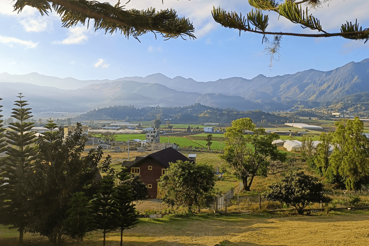
Constanza's farming identity is unusually visible: potatoes, onions, garlic, carrots, tomatoes, strawberries, peppers, greens, herbs, flowers and other cool-climate crops are part of the working landscape.
Do not enter working farms or promise harvest/picking activities without a verified operator-specific arrangement.
Look for the Japanese migration layer in local history
Japanese postwar settlement is documented in Constanza, and the municipality later formalized a sister-city relationship with Matsudo, Japan that includes agriculture and culture.
Present this as one strand of Constanza's modern history, not as a claim that Japanese immigrants alone created the valley's agricultural economy.
See Jimenoa and Baiguate as separate waterfall outings
Jarabacoa's waterfall identity is anchored by the Jimenoa falls and Salto de Baiguate. Baiguate has a roughly 25-meter drop and developed visitor steps; access and swimming conditions can still change with weather or temporary controls.
Do not promise that every waterfall or pool is open for swimming on every date. Check official/local conditions before a tightly timed visit.
Raft the Yaque del Norte with a legitimate operator
Official tourism identifies guided rafting on the Yaque del Norte as a core Jarabacoa adventure experience.
Confirm current age limits, departure schedule, river conditions, equipment and reservation rules directly with the operator.
Spend slow time at La Confluencia
La Confluencia is the riverfront area where the Jimenoa and Yaque del Norte meet, close enough to town to provide a lower-intensity counterpoint to rafting and trekking.
Treat onsite services as current/volatile rather than guaranteed.
Use Jarabacoa as the Pico Duarte gateway, not the summit itself
The popular route continues through Manabao and La Ciénaga into a multi-day protected-area trek to the Caribbean's highest summit.
Pico Duarte requires separate current planning for guides, trailhead, weather, registration/permit practices and pack-animal logistics.
Add a coffee/agriculture lens
Current official tourism promotion documents coffee interpretation in Jarabacoa, including cultivation, harvest and bean preparation.
Verify individual farm or processing visits before travel; do not treat one current operator as a permanent public attraction.
Use Bayahíbe as the real gateway to Saona
Most Saona excursions leave from Bayahíbe village. The island belongs to Cotubanamá National Park, with beaches, natural-pool stops and the inhabited community of Mano Juan forming part of many itineraries.
Confirm the exact operator, boat type, weather policy, stops, park procedures and return time for the travel date.
Explore Bayahíbe after the boats leave
The village is worth time on its own: local waterfront restaurants and bars, fishing-town activity, artisan stalls, small beaches and streets with older Caribbean architecture create a different evening rhythm after excursion traffic drops.
Do not schedule the town only as a five-minute transfer point if your trip is meant to include local atmosphere.
Visit Altos de Chavón with the modern-history context intact
Altos de Chavón is a modern designed village opened in 1982 above the Chavón River, with an amphitheater, church, shops, arts spaces and an archaeological museum. Its appeal is real, but it is not a preserved colonial settlement.
Non-resort visitors should verify current entry procedures and event-day restrictions before traveling to the controlled Casa de Campo property.
Add a protected cave visit at Cueva de las Maravillas
Between San Pedro de Macorís and La Romana, the cave combines limestone formations with protected Indigenous rock art on a visitor route that official tourism describes as unusually accessible by cave standards.
Check current hours, fees and entry procedures before a tightly timed visit.
Choose Catalina for a different marine day
Catalina lies closer to La Romana and is known for snorkeling and diving around reefs and established dive sites, creating a different excursion from the longer Saona day.
Cruise-ship use and sea conditions can change the experience; verify the actual departure and marine plan.
See the Chavón River as more than resort scenery
The river is both a striking landscape and part of the boundary between La Romana and La Altagracia. Official tourism documents boat, kayak and canoe experiences on its gorge-like lower reaches.
Use a current operator and confirm water/launch conditions rather than assuming self-guided access.
Read the city from Fortaleza San Felipe and the Atlantic waterfront
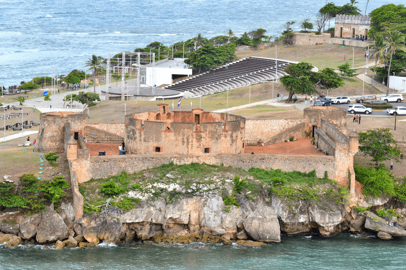
Use the 16th-century fort, La Puntilla and the Malecón as an introduction to Puerto Plata’s coastal history and present-day urban setting.
The fort is an anchor, not evidence that the entire historic center is an inscribed UNESCO World Heritage Site.
Walk the historic center with the right UNESCO context
Explore the city center as a living urban district with historic architecture and institutions. UNESCO currently lists the Historical Centre of Puerto Plata on the Dominican Republic’s Tentative List.
Say Tentative List, not World Heritage Site.
Treat Damajagua as a real adventure
27 Charcos combines forest hiking with guided jumps and slides through waterfalls and pools. Official tourism guidance notes that most excursions use a smaller sequence of falls and that the full route demands stronger fitness.
Confirm the current route, guide, equipment, swimming expectations and participation limits before going.
Choose a north-coast beach experience deliberately
Playa Dorada and Costa Dorada fit resort convenience; Sosúa offers a different town-and-water experience; Cabarete is strongest for surf and wind sports. These are not interchangeable beach labels.
Sea, wind and beach conditions change; avoid promising one universal swimming or watersports experience.
Give Cabarete its own watersports day
Cabarete’s identity is closely tied to surf, kitesurf and windsurf. Dominican tourism authorities renewed that positioning in 2026 through the Cabarete Surf & Wind City campaign.
Match the activity to current conditions and use qualified operators or instruction where appropriate.
Go west only when the extra geography is part of the plan
Punta Rucia and Cayo Arena can add snorkeling and a marine excursion, while La Isabela adds an archaeological and colonization-history stop. They make more sense as a deliberate western circuit than as downtown Puerto Plata add-ons.
Confirm current boat, weather and protected-area conditions for marine excursions.
Choose a beach zone instead of treating the coast as interchangeable
Bávaro is the main resort beach corridor, Macao brings surf and a more open local beach atmosphere, Juanillo sits inside the Cap Cana context, and Cabeza de Toro/Bibijagua/Los Corales each create different day-to-day experiences.
Check exact beach access and current sea conditions for the stretch tied to your lodging or day plan.
Spend at least one day outside the resort routine
The destination has real alternatives to a pool-and-buffet schedule. Ojos Indígenas adds forest and freshwater-lagoon context in the Puntacana area, while Hoyo Azul is a managed cenote experience inside Scape Park in Cap Cana.
Both operate under current property rules; verify access, schedule and entry terms rather than treating either as an unrestricted public site.
See the difference between Bávaro beach life and inland nightlife
Los Corales and El Cortecito connect beach restaurants and bars, while Friusa and Downtown Punta Cana support larger club, show and Dominican-music options. The experience changes significantly by subarea.
Use current WSD venue pages for the actual night; hours, tickets, lineups and pickup arrangements are date-sensitive.
Add a cultural half-day in Higüey
The Basilica Cathedral of Our Lady of La Altagracia gives the east-coast trip a strong connection to Dominican religious life and modern architecture in the provincial city of Higüey.
Dress respectfully and check worship/event schedules, especially around major feast dates.
Use Saona as a deliberate excursion, not as 'Punta Cana beach'
Saona Island is part of Cotubanamá National Park, and official tourism says most trips depart from Bayahíbe. Punta Cana packages commonly involve a road transfer before the boat portion.
Confirm the actual departure point, transport sequence and operator terms; do not assume the boat leaves from your resort beach.
See humpback whales only in the regulated season
Samaná Bay is a signature whale-watching area, with the activity managed through environmental authorizations and operator rules. Treat it as seasonal wildlife viewing, not an attraction available all year.
The 2026 season has ended. Confirm the next official season and authorized operators before booking a whale-specific trip.
Explore Los Haitises with route-level accuracy
Los Haitises brings mangroves, limestone karst, caves and protected ecosystems into the Samaná itinerary. The experience depends on the specific public-use route and gateway rather than one generic park tour.
Cueva de La Línea was temporarily closed in June 2026 because of its access pier; other enabled public-use areas continued operating.
Reach Salto El Limón without turning it into a race
El Limón is the peninsula’s classic inland waterfall excursion and official tourism material recognizes hiking and horseback approaches through the surrounding landscape.
Avoid stale promises about exact minutes, height, price or trail condition. Confirm the current access model.
Beach-hop Las Terrenas instead of choosing one “best beach”
Punta Popy, Las Ballenas, Playa Bonita and Cosón offer different combinations of town access, walking, swimming, surf and open-coast feel.
Atlantic conditions change. Read the water and follow local safety guidance rather than assuming every beach is calm.
Use Las Galeras for the eastern peninsula
Las Galeras is the better base when Playa Rincón and a quieter eastern-peninsula rhythm are central to the trip. Playa Rincón itself changes character across its long shoreline.
Do not treat Las Galeras as a quick neighborhood of Las Terrenas; travel times matter.
Spend time on the Samaná Bay waterfront
Santa Bárbara adds a real town and bayfront dimension to a trip that can otherwise become a string of excursions. Its reconstructed Malecón connects boats, public space and provincial life.
Whale season and cruise activity can change the waterfront rhythm by day.
Taste the peninsula rather than chase a restaurant list
Fresh fish, Sánchez shrimp, coconut, ginger and pescado con coco give Samaná a recognizable regional food identity, while Las Terrenas adds a wider international dining mix.
Use named restaurants only after a fresh operational check. The rebuilt Pueblo de los Pescadores is a renewed public plaza, not the unchanged pre-2021 row.
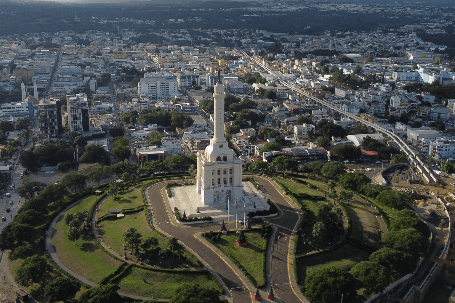
Start at the Monumento, then understand what it represents
The Monumento a los Héroes de la Restauración is Santiago’s defining civic landmark and a museum space tied to the Restoration story. Its setting also helps visitors understand the scale and layout of the modern city.
Treat interior access, exhibitions and viewpoint availability as current operating details; verify them before a tightly timed visit.
Give Centro León real time
Centro León is not a token museum stop. Its exhibitions and collections use art, archaeology, ethnography, popular culture, photography and other disciplines to examine Dominican identity in a Caribbean context.
Check the institution’s current exhibition and activity calendar; do not rely on an old list of rooms or temporary shows.
Walk the historic center with 2026 conditions in mind
Parque Duarte, Calle del Sol and nearby civic, religious and cultural buildings reveal Santiago’s older urban fabric and commercial history. Several public spaces have been restored, while Calle del Sol remains a live reconstruction project.
Build flexibility into the walk. Access and traffic patterns can change around active work zones.
Learn the tobacco story without turning it into an ad
Tobacco and cigar making are deeply connected to the Cibao economy and Santiago identity. A legitimate factory visit can show sorting, preparation, rolling, packing and the labor behind a globally known Dominican industry.
Confirm the visitor program directly before going. Current age, reservation, weekday and access rules belong to the operator, not evergreen WSD copy.
Eat Santiago as a Cibao city
Santiago’s food experience is strongest when street traditions and everyday Dominican eating sit beside the city’s newer restaurant scene. Local tourism material highlights quipe, rikitaki and yaroa among recognizable Santiago street foods.
Use individual restaurants as fresh recommendations only after an operational check; the destination guide should explain food culture rather than freeze a ranking.
See baseball when the season is actually on
Estadio Cibao and Águilas Cibaeñas make professional winter baseball one of Santiago’s clearest live cultural experiences. The atmosphere matters as much as the box score for visitors trying to understand Dominican baseball culture.
Games are seasonal, generally mid-October through late January. Check the current LIDOM/team schedule before promising a game.
Use the city’s live arts calendar
Gran Teatro del Cibao, Casa de Arte, Centro Cultural Ercilia Pepín and other venues keep Santiago’s cultural identity active rather than museum-only. Merengue típico, theater, concerts, exhibitions and community events belong in the trip when calendars line up.
Do not promise a specific performance or live-music format without checking the actual date and venue calendar.
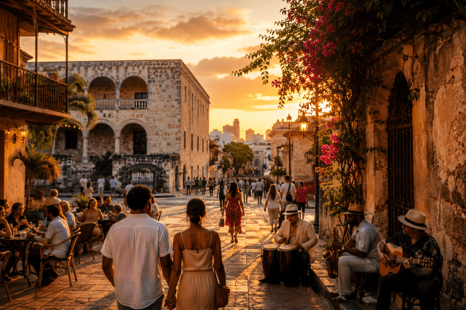
Walk the Colonial City with context
Use Parque Colón, Calle Las Damas, the Cathedral area, Fortaleza Ozama, Plaza España and the Alcázar de Colón as a connected urban story rather than a checklist of “firsts.” The district is a living neighborhood as well as a World Heritage site.
Allow time to walk, sit in the plazas and enter only the museums or monuments that genuinely interest you.
Choose at least one serious museum or cultural institution
Santo Domingo’s story becomes much richer when the trip includes a museum, archive, visual-arts space or performing-arts institution rather than relying only on outdoor monuments.
Verify current opening days and any renovation impacts before building a schedule around one institution.
See the city from the Caribbean waterfront
The Malecón gives Santo Domingo a different scale: sea, traffic, public space, hotels, recreation and an urban edge that contrasts sharply with the enclosed streets of the Colonial City.
Pick a specific segment and time rather than expecting the full avenue to function like one continuous pedestrian attraction.
Spend time in modern Santo Domingo
Piantini, Naco and the Polígono Central reveal the contemporary capital through restaurants, shopping, business activity and evening social life. This is essential to understanding Santo Domingo as more than a heritage district.
Keep named restaurant and nightlife recommendations in freshness-sensitive Food and Nightlife coverage.
Cross into Santo Domingo Este for Los Tres Ojos
The cave-and-lagoon landscape of Los Tres Ojos provides a dramatic nature break close to the urban core and makes the metropolitan geography visible: this major attraction is east of the Ozama, outside the Distrito Nacional.
Treat it as a deliberate cross-city outing and verify current access details before departure.
Make room for living culture
Depending on the calendar, Santo Domingo can add live Dominican music, baseball, theater, festivals or other public cultural programming to the trip. The point is not one guaranteed event; it is to experience the capital as a place where Dominican culture is still being made.
Schedules are volatile. Verify the exact event, venue and ticket/access rules close to the visit.
Explore by destination
Related Travel stories
No matching Travel stories are published yet.