
Geography and orientation
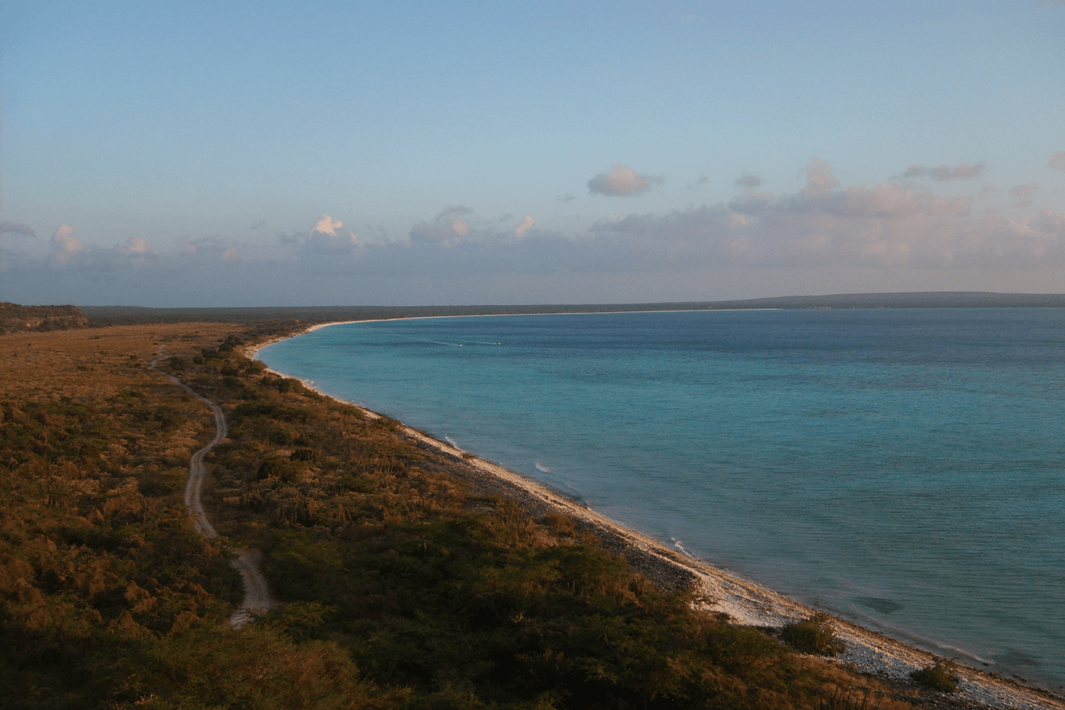
Barahona and Pedernales form one of the Dominican Republic’s strongest road-trip combinations, but they are two separate provinces in the southwest. Barahona is the greener, more populated starting side, with a provincial capital, pebble beaches, cold rivers and coffee-growing mountain country. Pedernales continues toward the Haitian border through drier landscapes, protected parks, Bahía de las Águilas, Laguna de Oviedo and Sierra de Bahoruco.
The road itself is part of the experience. South of Barahona city, the Caribbean highway threads past San Rafael, Paraíso, Los Patos and Enriquillo before reaching Oviedo, Cabo Rojo and Pedernales. That sequence matters more than treating the trip like one resort destination.
Why go
Choose Barahona & Pedernales when you want the Dominican Republic at road-trip scale: cold rivers meeting the sea, stone beaches, coffee country, dry forest, wetlands, high-elevation forest, protected Caribbean coastline and border-region culture in one journey.
The reward is diversity rather than convenience. This is not the place to expect Punta Cana-style resort density or to improvise every day without transport planning. It works best for travelers who enjoy long scenic drives, nature stops and a slower progression south and west.
Areas and neighborhoods
Barahona city / Malecón
The urban anchor of the trip, useful for lodging, supplies, the waterfront, local dining and evening life before heading down the coast.
Use it as the main service base for fuel, cash, supplies and transport planning rather than treating it as the region’s primary beach zone.
San Rafael / Paraíso
A dramatic coastal stretch where mountain water, steep green slopes and pebble beaches meet the Caribbean. San Rafael is the best-known river-to-sea stop in this corridor.
River and surf conditions vary. Some natural-pool facilities are managed privately; confirm access and do not assume calm swimming conditions.
Los Patos / Enriquillo coast
A classic southwest road-trip sector built around pebble beaches, the Los Patos River, roadside food and the transition from Barahona’s greener coast toward drier Pedernales landscapes.
Treat river and sea conditions separately; a pleasant river pool does not mean the adjacent surf is safe.
Polo / Sierra de Bahoruco coffee country
The mountain side of the Barahona trip, associated with cooler elevations, coffee production, rural roads and access toward the Sierra de Bahoruco landscape.
Mountain-road and farm-visit logistics vary more than coastal-highway travel. Confirm access before building a tight schedule.
Oviedo / Laguna de Oviedo / Jaragua
The wetland-and-dry-forest side of Pedernales, where Laguna de Oviedo and Jaragua add birdlife, iguana habitat, cayes and protected coastal ecosystems.
Wildlife is never guaranteed. Use current local or park guidance for guide, boat and visitor-center procedures.
Cabo Rojo / Bahía de las Águilas
The iconic protected-beach corridor and the center of Pedernales’ rapidly changing tourism infrastructure. Bahía de las Águilas remains the natural centerpiece while Cabo Rojo now combines an operating cruise port with major hotel and airport development.
Do not assume resort services on the protected beach. Bahía de las Águilas requires suitable land access or a boat, while Cabo Rojo infrastructure changes quickly.
Pedernales town / border
The provincial capital and border-town base at the far southwest, useful for lodging, services and understanding that the destination is also a lived-in frontier community.
Border procedures and any Haiti-related travel require current official security and immigration guidance.
Hoyo de Pelempito / high Sierra de Bahoruco
The highland contrast to the dry coast, reached by a long climb through changing vegetation toward the Hoyo de Pelempito viewpoint and Sierra de Bahoruco ecosystems.
Use a suitable vehicle and current access guidance. Elevation, road conditions and weather can make this a very different day from the coast.
Essential experiences
Drive the Barahona–Pedernales coastal road slowly
The sequence of San Rafael, Paraíso, Los Patos, Enriquillo and the increasingly dry southwest is the organizing experience of the destination. Stopping between rivers, viewpoints and pebble beaches is more valuable than racing straight to Pedernales.
Fuel, daylight and road time matter. Build margin instead of stacking too many nature stops into one transfer day.
Experience Bahía de las Águilas as a protected-area visit
The beach is famous for white sand and clear water, but its significance is also that it remains inside the Jaragua protected landscape without hotels, shops or restaurants on the beach itself.
Bring sun and water planning and confirm current all-terrain vehicle or boat access.
Take a guided Laguna de Oviedo nature outing
Laguna de Oviedo adds a brackish wetland, cayes, birdlife and iguana habitat to a trip otherwise dominated by coast and mountains.
Wildlife sightings vary. Confirm current guide/boat arrangements and park procedures.
Climb into Sierra de Bahoruco and Hoyo de Pelempito
The highland road reveals one of the southwest’s strongest ecological contrasts, moving from dry lowlands toward cooler forest and the Hoyo de Pelempito viewpoint.
Use current park/road guidance and a suitable vehicle. Do not treat an old access report as proof of present road condition.
Stop for the river-to-sea landscapes of San Rafael and Los Patos
These stops explain why Barahona feels different from the sandy-beach postcard version of the Caribbean: cold river water, pebble shorelines, steep mountains and powerful surf sit within a few meters of each other.
Follow local water-safety conditions separately for river pools and open sea.
Connect Barahona to larimar and coffee instead of only scenery
Barahona’s identity also comes from material and agricultural culture. Larimar is closely tied to the region, while coffee routes and mountain farms add another reason to leave the coastal highway.
Use verified workshops, farms or current tours; do not enter mines or farm sites without permission.
Spend time in Barahona and Pedernales as towns
The urban centers anchor the road trip with local commerce, food, services and evening life. Giving them time prevents the southwest from becoming a checklist of landscapes with no human context.
Keep normal urban travel awareness and arrange late-night transport rather than assuming resort-style visitor infrastructure.
Culture and history
The southwest belongs to the historic Enriquillo/Jaragua landscape and carries Indigenous, border, agricultural and extraction histories alongside its protected nature.
Barahona developed as a port and regional city surrounded by sugar, coffee and later larimar-related activity. Its modern identity reaches from the Malecón into mountain communities and the coast toward Paraíso and Enriquillo.
Pedernales combines border-community life with some of the country’s most important protected landscapes. That context is changing quickly around Cabo Rojo, where the Dominican government is building a large tourism district around an operating cruise port while formally committing to keep Jaragua, Sierra de Bahoruco and the protected Cabo Rojo–Bahía de las Águilas polygons outside the development footprint.
Food
The most useful food framing is geographic rather than a fake single regional dish. Barahona city provides the broadest everyday dining base, while the coastal road adds roadside fish, seafood and Dominican cooking around beach and river stops. Pedernales town has a smaller local-service scene shaped by fishing and border-region life.
Coffee belongs in the mountain side of the Barahona story, especially around Polo and the Sierra. The point is the same as with larimar: regional production and craft are part of why stopping in communities matters.
Avoid freezing restaurant rankings into the destination guide. Current businesses and hours should live in service and venue coverage.
Where to base yourself
Barahona city is the best first base for the northern half of the route because it has the deepest lodging/service pool and puts San Rafael, Paraíso, Los Patos and mountain detours within reach.
Pedernales town is the practical base for Bahía de las Águilas, Cabo Rojo and Pedernales-side highland exploration. It keeps you from turning every protected-area day into an extreme round trip from Barahona.
A split stay is stronger than trying to see the entire corridor from one hotel. Travelers focused heavily on nature can also use smaller coastal or mountain lodgings, but should verify road access, meals and power/connectivity expectations before committing.
Getting there
The southwest is primarily a road-trip destination. Official tourism uses roughly three hours by road from Santo Domingo to Barahona and about five to six hours for Pedernales, though actual travel varies with stops and road conditions.
Las Américas International Airport remains the most practical major air gateway for a conventional road itinerary today. Do not plan around Cabo Rojo International Airport yet: the government reported it still under construction in 2026 with first operations targeted for 2027.
Port Cabo Rojo is already receiving cruise traffic, but a cruise call and an independent overland trip are different products. The destination page should not treat cruise-port transport as general regional mobility.
Getting around
A car or arranged driver is the most flexible way to understand this corridor. The attractions are spread across two provinces, and many of the best stops sit between towns rather than inside walkable centers.
A standard road vehicle can handle the main highway, but particular protected-area and highland approaches may require higher clearance, 4x4 capability or local transfer arrangements. Bahía de las Águilas is the clearest example: official tourism identifies all-terrain vehicle or boat access.
Do not treat distance alone as the planning metric. Heat, mountain roads, park procedures, photo stops and swimming breaks can turn a seemingly short map segment into a full day.
When to go
Official tourism promotes both provinces year-round while identifying December through April as the drier period and Pedernales’ main high season. That is useful planning context, not a guarantee of beach, road or marine conditions.
The region contains strong climate contrasts: hot dry lowlands, exposed coast, cold river water and much cooler high elevations in Sierra de Bahoruco. Packing only for a beach day can be a mistake on a Hoyo de Pelempito itinerary.
Semana Santa and summer can increase domestic visitor traffic around Barahona’s rivers and beaches. Cruise calls can also change activity around Cabo Rojo. Verify time-sensitive conditions if your plan depends on quiet access or a specific protected-area service.
Suggested trip length
Official tourism suggests roughly 2–4 days for Barahona and 3–5 for Pedernales. For the combined WSD road trip, four nights is the minimum that begins to make sense; five to seven nights is much better for splitting bases, stopping along the coastal road and giving both Jaragua and Sierra de Bahoruco their own time.
A rushed two- or three-night version usually forces the traveler to choose between Barahona’s river-and-coast sequence and Pedernales’ protected areas. The southwest rewards margin more than checklist speed.
Nearby excursions
Lago Enriquillo and Isla Cabritos form the strongest inland extension from the broader Enriquillo region, but they are not a casual detour from every point on the coast. Treat them as a separate day with current access and heat planning.
Future WSD coverage of the Independencia/Neiba side should become the stronger destination relationship for Lago Enriquillo rather than stuffing the full inland basin into this coastal road-trip page.
Current notes
Frequently asked questions
Should I combine Barahona and Pedernales in one trip?
Yes. They are separate provinces, but the coastal road links them into one of the Dominican Republic’s strongest nature road trips. A split stay—usually Barahona first, then Pedernales—works better than trying to cover everything from one base.
How many days do I need for Barahona and Pedernales?
Four nights is a practical minimum for a combined trip. Five to seven nights is better if you want the Barahona coast, Bahía de las Águilas, Laguna de Oviedo and a Sierra de Bahoruco day without rushing.
Do I need a 4x4?
Not for every mile of the main coastal highway, but some protected-area and mountain approaches may require higher clearance, a 4x4 or a local transfer. Official tourism specifically identifies all-terrain vehicle or boat access for Bahía de las Águilas.
Can I fly directly to Cabo Rojo or Pedernales?
Do not plan on it yet. The Cabo Rojo international airport was still under construction in 2026, with first operations targeted for 2027. Verify live airline and airport information before assuming direct service.
Is Bahía de las Águilas a resort beach?
No. It is a protected beach in the Jaragua landscape, and official tourism describes it without hotels, shops or restaurants on the beach itself. Plan water, sun protection and access separately.
What is the difference between Barahona and Pedernales?
Barahona is greener and more urbanized, with the provincial capital, rivers, pebble beaches, coffee country and the northern half of the scenic coastal road. Pedernales is drier and more sparsely developed, with Jaragua, Bahía de las Águilas, Laguna de Oviedo, Sierra de Bahoruco and the border-town/Cabo Rojo context.